
Please introduce yourself, tell us a little bit about where in the region you are based, and share some of the major ideas and themes you engage with in your practice.
My name is Sarabel Santos-Negrón, and I am a visual artist, educator, curator, and museum professional. I am from Bayamón, a municipality on the northern coast of Puerto Rico, where I currently live and work. My artistic practice is informed by the study of nature through its social, political, and ecological territories. I am interested in examining the relationships between land, landscape, identity, memory, and structures of power, particularly within the context of Puerto Rico and the Caribbean.
Through installations, drawings, and research-based projects, I explore how territories are shaped by histories of colonialism, economic development, environmental transformation, and collective belonging. My work considers land not only as a physical space, but also as a cultural, political, and symbolic construct that reflects broader questions of access, ownership, conservation, and social justice.
In addition to my artistic practice, I have worked in education for more than fifteen years and, since 2016, I have served as Executive Director of the Bayamón Museum of Art. This experience has profoundly influenced my understanding of art as a tool for dialogue, learning, and community engagement. I am also a co-founder of _SITIO// Espacio y Taller Interdisciplinario de Arte, a platform that promotes artistic exchange, arts education, and solidarity among artists from Puerto Rico and the Caribbean.
Across all aspects of my work, I am interested in creating spaces for critical reflection on our relationship with territory, the environment, and the social structures that shape our everyday lives.


Tell us about your experience carrying out and interacting with the community through your exhibition project in Santa Olaya, Bayamón, and were there notable reactions sharing your work in a rural context?
This project emerged from the rural area of Bayamón, specifically Santa Olaya, where I spent much of my childhood and youth. Although Bayamón is primarily recognized as a city, approximately half of its territory is composed of rural land. After losing our home during Hurricane Maria and facing the difficult process of rebuilding it, I began to reflect on who has access to land and what it truly means to have the opportunity to build a home upon it. These concerns arose within a political and economic context in which foreign investment is encouraged through generous tax incentives, while those of us who live on the island do not always have access to the same opportunities.
From that experience, I began engaging in conversations with members of the community in Santa Olaya. A common aspiration emerged repeatedly: the desire to own a piece of land, to have a home of one’s own, or, for those who already have one, the ability to preserve it in the face of current economic and social pressures. These concerns led me to study the topography of Bayamón through satellite imagery, examining areas of greater population density and urban development in contrast to rural zones.


The initial result was a series of drawings that identified, through organic forms, the most heavily built-up areas in relation to those that were less populated or nearly untouched. This exercise encouraged me to expand the research to neighboring municipalities and, eventually, to study all 78 municipalities of Puerto Rico under the same premise. Through this process, I came to understand that challenges related to access to land are not exclusive to any particular region, but rather a reality that extends across the entire country.
Interacting with residents from different municipalities, as well as collecting materials from diverse locations, allowed me to better understand the many ways people relate to territory. Each place possesses its own geographic, social, and cultural characteristics, yet they also share similar concerns regarding belonging, housing, and the preservation of natural spaces.
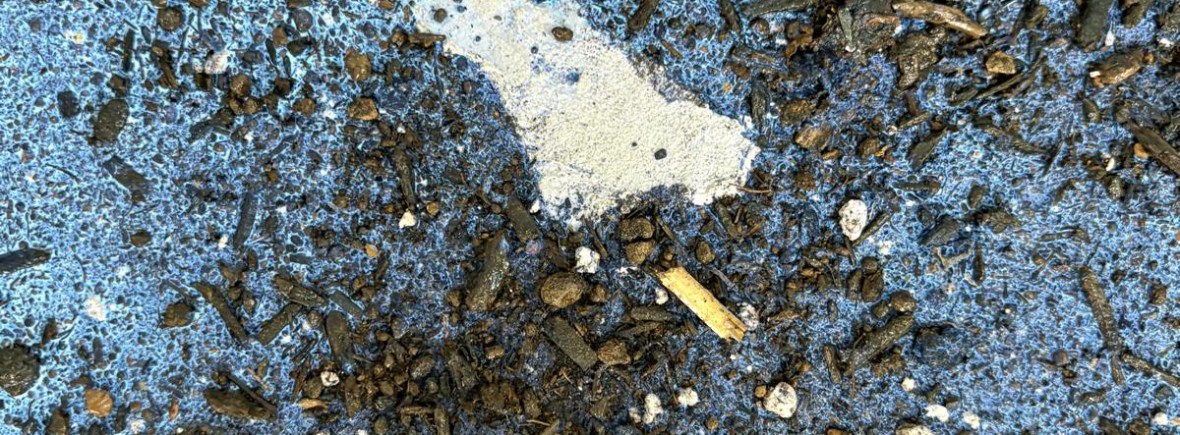
From this process emerged Promised Topography, an installation composed of 78 tiles, each representing one municipality of Puerto Rico as if it were a parcel of land. Each tile contains a material-based drawing that depicts its urban, rural, and coastal areas. To create them, I collected soil and sand from different parts of the island to represent rural and coastal zones, while cement was used to reference urban development. It is a tangible territory transformed into a symbol, where the very materiality of the work establishes a direct connection to the land it represents. The 78 pieces are installed as a floor on the ground. The installation transforms the ground into an object viewed from above, like a map or satellite image, inviting viewers to question who truly has access to that “ground”.


In addition to initiatives like TENDER, what other kinds of support or programming geared towards the needs of contemporary creative practitioners would you like to see implemented in the Caribbean?
I consider it necessary to develop more programs for gatherings among Caribbean artists, both in-person and virtual, where creative processes, works in progress, and research can be shared and discussed. It is also essential to create more opportunities to exhibit work in cultural spaces, galleries, and museums across the region.
These types of initiatives would help strengthen ties among artists, cultural managers, and curators from the different Caribbean islands, fostering the exchange of knowledge, experiences, and perspectives. At the same time, they would allow communities to have greater access to contemporary artistic production from other parts of the Caribbean, promoting a broader understanding of our shared realities and the cultural diversity that characterizes the region.

